CREWES works with industry partners in conducting research in resource exploration and development.
Jan. 25, 2016

CREWES works with industry partners in conducting research in resource exploration and development.
One of the University of Calgary’s longest-operating, internationally respected research groups is poised to take seismic imaging science to the next level, thanks to new federal funding.
The Consortium for Research in Elastic Wave Exploration Seismology (CREWES) has been awarded a prestigious $2,168,000 Collaborative Research and Development grant over five years by the Natural Sciences and Engineering Research Council of Canada (NSERC).
“This is a pivotal grant for us, and we take it as a sign of the importance of the scientific challenges we’re addressing,” says Kris Innanen, associate professor of geophysics and director of CREWES.
“Our goal is to use seismic measurements to create images of the Earth — detailed maps of geological structures," he says. "Then, to determine the properties of the structures: the way they are fractured, whether fluid is within them, and whether it is flowing or can flow, whether the rocks are under a lot of stress. These are, in principle, within our grasp, but there are missing scientific ideas, and practical technologies. The funding supports creating and providing these.”
The highly competitive NSERC grant entails proposing a detailed research program for several years, plus a site visit by a team of distinguished scientists.
Working with industry partners to advance resource exploration
CREWES, based in the Department of Geoscience in the Faculty of Science, is 28 years old this year. The applied geophysical research group focuses on acquiring, analyzing and interpreting multicomponent seismic data, including 3D geological images of the subsurface.
CREWES works with industry partners in conducting advanced research in resource exploration and development. The consortium currently has 18 industrial sponsors, including some, like Chevron, ExxonMobil, and Halliburton, that have been with CREWES since it began along with other long-standing sponsors such as CGG, Devon, INOVA and Repsol.
Seismic imaging science has continuously evolved since the 1930s. Even today, scientists don’t understand all the physics involved in a seismic wave as it propagates through the Earth.
Gary Margrave, emeritus professor of geophysics, past CREWES director and primary author of the proposal, says that with the support from the grant, “we plan to take seismic imaging to a new level of physical and mathematical precision and accuracy.
“The science is by no means done," he says. "For example, we’re constantly improving the sophistication of our physics models of rocks."

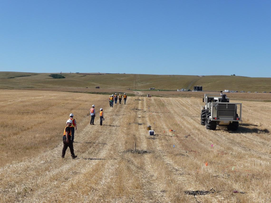
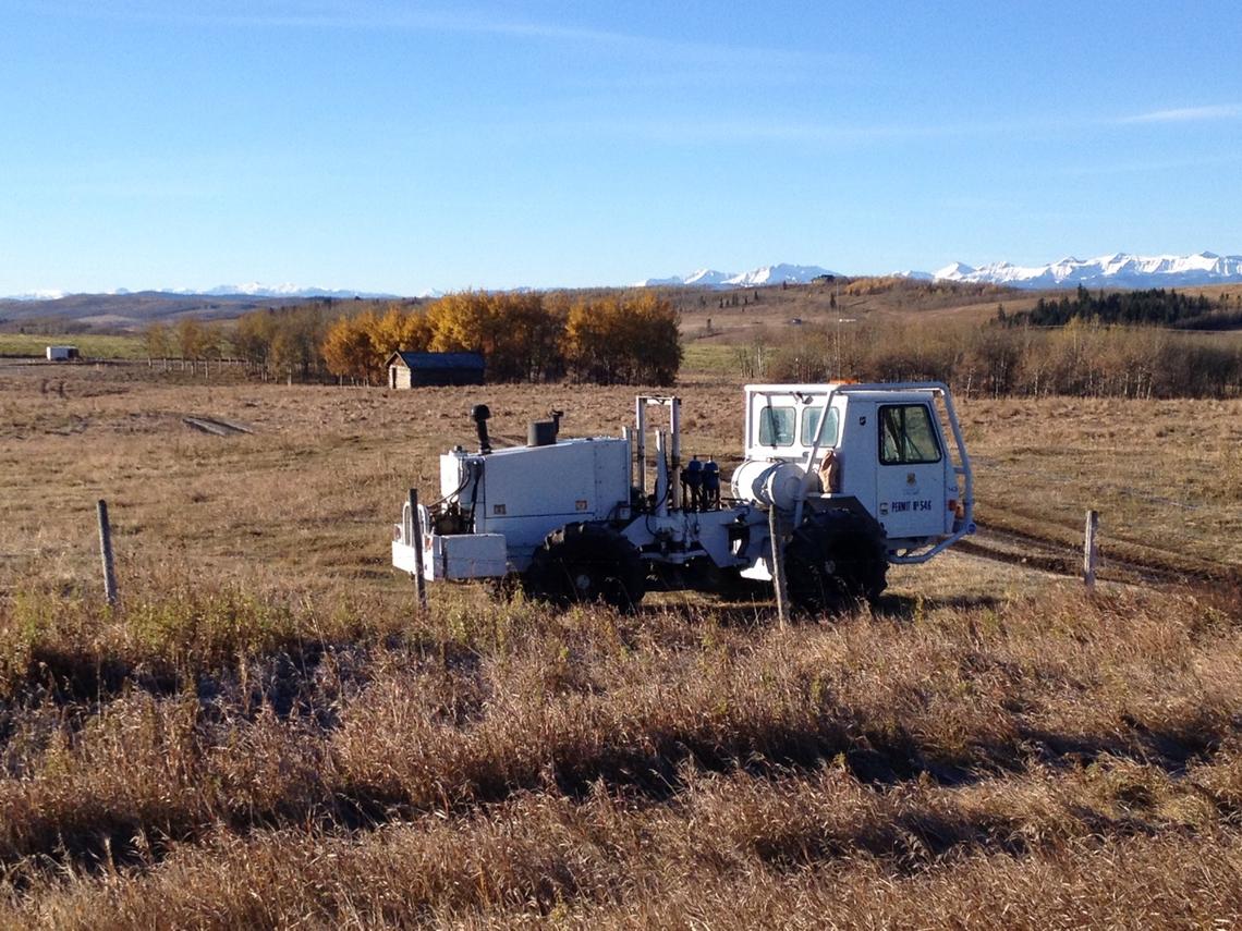
CREWES has its own-state-of-the-art equipment to conduct advanced seismic surveys.
Advances in seismic imaging can reduce risk and help environmental monitoring
Current seismic imaging techniques reveal mainly the shapes and structures of layers of subsurface rock. But what is also crucial to know — especially in finding oil and gas reservoirs — is the type of rock and the fluids within the rock pore spaces.
“What we’re hoping to do is advance our ability, and advance the ability of the imaging industry, to deduce with some degree of certainty the nature of these rocks and these fluids,” says Margrave, who, as outgoing director, still works closely with CREWES.
“The world around us today — energy needs, the price of oil, the outcomes at Paris, the concern our society as a whole registers about risks in fracking and other production methods, so clearly points to the importance of technological breakthroughs,” Innanen says. “And for us, this means being able to deduce from seismic imaging the properties of these subsurface systems. From this comes the information needed to reduce waste, cost, and risk.”
This advanced imaging would significantly reduce the risk for oil and gas companies of drilling and not finding economically producible hydrocarbons.
“That benefit is huge to the industry and to the country,” says Margrave.
More advanced imaging is also needed for environmental monitoring of carbon storage projects, to ensure the greenhouse gas carbon dioxide injected underground remains in the geological reservoir.
State of the art equipment used to conduct seismic surveys
Don Lawton, CREWES associate director, is involved in a joint project between CMC Research Institutes Inc. and the University of Calgary in a new field research and training station for injecting, monitoring and containing CO2, being developed on industry-owned land in southeastern Alberta.
The consortium is one of the few research groups in North America with its own state-of-the-art equipment to conduct advanced seismic surveys. This includes a very large “vibe” vehicle whose 17,000-pound-force vibrator can send sound waves more than two kilometres deep underground.
In March 2011, a group of University of Calgary geoscientists, led by Lawton, took their vibe and seismic recording system to New Zealand to assess the potential for more earthquakes in the Christchurch area after the city’s devastating Feb. 22 earthquake.
About 50 people are actively involved in CREWES including four faculty members in geoscience, nine staff and 30 graduate students, along with adjunct directors. The high quality of CREWES’s work is recognized internationally, with the consortium’s datasets sold through the Society of Exploration Geophysics to customers around the world.
As of the end of January, the group has had 111 masters students and 40 PhD students defend their theses; 95 per cent of CREWES students also find jobs in their field.
“We’re incredibly gratified at the continued enthusiastic support for this research,” says Innanen. “There are a huge number of questions still to be answered, and this support is allowing us to go right to the heart of the important ones.”
Located in the heart of Canada's energy sector, the University of Calgary has built a reputation as a global leader in energy research and innovation. With a focus on our low-carbon future, diverse teams are also assessing the effects of energy-related processes while harnessing unconventional hydrocarbon resources through the Energy Innovations for Today and Tomorrow research strategy.